India received near-normal rainfall during the past week, and the overall southwest monsoon deficit has now reduced to 17% since June 1. At the same time, El Niño conditions over the equatorial Pacific are strengthening, raising concerns over rainfall distribution during the remainder of the monsoon season. The India Meteorological Department (IMD) has forecast a mixed rainfall pattern over the next two weeks, with heavy showers likely in parts of western, central and eastern India, while several other regions are expected to receive below-normal rainfall.
According to IMD, rainfall during the week from July 16 to July 22 was 1% below the Long Period Average (LPA) for the country as a whole, which falls in the normal category. All four homogeneous regions also recorded normal rainfall except the South Peninsula, where precipitation was 26% below normal, indicating a continuing weak monsoon over southern India.
Despite the improved performance during the week, the seasonal rainfall position remains weak. Between June 1 and July 23, the country received 306.9 mm rainfall against the normal of 370.9 mm, leaving an overall deficit of 17%.
Region & Statewise Rainfall
Among the four homogeneous regions, East and Northeast India continue to be the worst affected, with rainfall 32% below normal. South India has also recorded a substantial 26% deficit, while Northwest India is 10% below normal and Central India has fared relatively better with a deficit of just 6%.
Photo: Statewise rain so far. Blue colour denotes excess, green normal and red colour shows deficient rainfall.
Only Ladakh and Jammu & Kashmir have recorded above-normal rainfall so far this monsoon season. Rainfall has remained within the normal range in Himachal Pradesh, Uttarakhand, Uttar Pradesh, Rajasthan, Madhya Pradesh, Maharashtra, Tamil Nadu, Chhattisgarh, Odisha, West Bengal and Tripura. However, Punjab, Haryana, Gujarat, Goa, Karnataka, Kerala, Telangana, Andhra Pradesh, Bihar, Jharkhand and all the northeastern states except Tripura continue to face rainfall deficits ranging from 20% to 58%.
Strengthening El Niño Conditions
Meteorologists have also pointed to the strengthening El Niño conditions over the equatorial Pacific Ocean as a factor that could influence rainfall during the remaining monsoon season. Sea surface temperatures across the central and eastern Pacific continue to remain above normal, and forecasts from the Monsoon Mission Coupled Forecast System (MMCFS) indicate that El Niño conditions are likely to strengthen further through the southwest monsoon season.
Forecast for the Next Two Weeks
For the week July 23-29, IMD expects several weather systems to influence rainfall across the country. The monsoon trough is likely to shift north of its normal position during the second half of the week, while an anomalous cyclonic circulation is expected to develop over the northeast Arabian Sea and adjoining Saurashtra coast. Active western disturbances are also likely to affect northwest India.
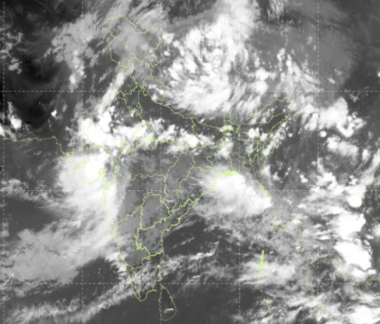
Under the influence of these systems, western India is expected to receive above-normal rainfall, with heavy to very heavy rainfall and isolated extremely heavy falls likely over southeast Rajasthan, the Gujarat region, north Konkan and north Madhya Maharashtra during the next three days. Fairly widespread to widespread rainfall with isolated heavy to very heavy showers is also forecast over the Northeast, East India and the Western Himalayan region, while the plains of northwest India may witness increased rainfall during the second half of the week. Thunderstorms accompanied by lightning and gusty winds are also likely over parts of the country.
Although rainfall over the country is expected to remain normal during the next two days, IMD has projected below-normal rainfall during the remaining days of the week. Overall, rainfall activity is likely to be normal to above normal over South Rajasthan, West and Central India, and many parts of East India, while the remaining regions are expected to receive below-normal rainfall.
For the second week, July 30 to August 5, the monsoon trough is expected to return closer to its normal position. An upper-air cyclonic circulation is likely to develop over the north and adjoining west-central Bay of Bengal, while the low-level Somali Jet is expected to strengthen.
During this period, widespread rainfall is forecast over the Western Himalayan region, with isolated heavy to very heavy rainfall likely in Jammu & Kashmir, Himachal Pradesh and Uttarakhand. Northeast India is expected to receive widespread rainfall, with heavy spells over Arunachal Pradesh, Assam, Meghalaya and Sikkim. The west coast, including Konkan & Goa, Coastal Karnataka and Kerala, is also likely to witness widespread rainfall with isolated heavy to very heavy showers. Overall, IMD expects normal rainfall for the country during the week, with near-normal to above-normal rainfall over most parts of South Peninsular India and many parts of East and Central India, while the remaining regions are likely to receive below-normal rainfall.