
Land Stack: Every Land Parcel to Receive a 14-Digit Bhu-Aadhaar (ULPIN), Full Georeferencing of Cadastral Maps
The new land records framework aims to integrate cadastral maps, ownership records, property registrations and court cases while improving transparency and reducing land disputes.

 Join the RuralVoice whatsapp group
The Ministry of Rural Development has launched the operational guidelines for the third phase of the Digital India Land Records Modernisation Programme (DILRMP 3.0), introducing a nationwide framework under which every land parcel will receive a unique 14-digit Bhu-Aadhaar, also known as the Unique Land Parcel Identification Number (ULPIN).
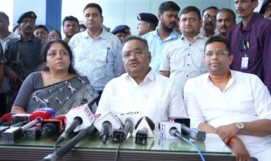
Union Minister for Rural Development Shivraj Singh Chouhan formally launched the guidelines at a hybrid event in New Delhi on Thursday, attended virtually by State Revenue and Registration Ministers, Principal Secretaries, and senior officials from across the country.
Union Minister Shivraj Singh Chouhan stated that DILRMP 3.0 is a decisive step toward improving the ease of living for rural citizens, farmers, and property owners. He underscored that land in India is deeply tied to emotional and familial identities, making accurate and accessible documentation vital. He pointed out that the earlier phases of DILRMP successfully digitized 99.90% of Records of Rights (RoRs) and 97% of cadastral maps, while 99% of Sub-Registrar Offices (SROs) have been computerized.
“DILRMP 3.0 now raises the bar by moving from isolated digitization to full system integration, ensuring farmers can secure institutional credit more easily and citizens are spared repeated visits to government offices,” Chouhan added.
Narendra Bhooshan, Secretary, Department of Land Resources (DoLR), set the context for the guidelines, noting that DILRMP 3.0 marks a shift toward building an integrated Digital Public Infrastructure (DPI) for land administration.
DILRMP 3.0 will be implemented across all States and Union Territories with 100% central funding under a phased, performance-linked mechanism.

GIS-Enabled ‘Land Stack’
The Land Stack, an integrated digital framework, will bring together different layers of land-related information, including georeferenced cadastral maps, Records of Rights, property registrations, and relevant court matters through GIS-based digital interfaces. It will enable each State to develop its own Land Stack by integrating various land-related datasets and systems through APIs.
These State-level Land Stacks will, in turn, form the building blocks of a National Land Stack, which will be developed in a federated manner. This will enable seamless interoperability and exchange of information across States while retaining ownership and control of data with the concerned authorities.
Universal Bhu-Aadhaar (ULPIN)
A key feature of DILRMP 3.0 is the Universal Bhu-Aadhaar, or ULPIN, under which each land parcel will be assigned a unique 14-digit identification number.
The system is intended to establish an unambiguous digital identity for land parcels, reduce the possibility of fraudulent transactions, and make it easier to verify ownership and property-related information.
Legacy Land Records to Be Digitized
The programme also provides for the systematic scanning and digital archiving of historical land and property registration records. The move is aimed at preserving inheritance-related documents and reducing disputes over ancestral property.
As part of the initiative, 75 high-footfall Sub-Registrar Offices will be modernized into citizen-friendly service centers with digital queue management and improved amenities, drawing inspiration from Passport Seva Kendras.
A secure digital Registration Repository will also be developed to maintain registered deeds and encumbrance information, enabling ownership verification, transaction-history checks, and property due diligence.
Paperless Revenue Courts
DILRMP 3.0 will also seek to modernize revenue court proceedings through an upgraded Revenue Court Case Management System (RCCMS). The system will be linked directly with land records to reduce case pendency and expedite mutation settlements.
Urban Land Mapping (NAKSHA)
The programme will simultaneously accelerate the NAKSHA pilot project for urban land mapping. The initiative is intended to create accurate GIS-based urban land records and facilitate the issuance of Urban Property Cards, or UrPro Cards. Progress will be monitored in real time through an upgraded DILRMP Management Information System (MIS) dashboard under the supervision of the Project Sanctioning & Monitoring Committee.