IIT Madras Develops Real-Time Indoor Mapping Tech for Disaster Response
‘UbiqMap’ uses wireless imaging to create near-accurate maps of indoor environments with minimal reliance on pre-deployed infrastructure or physical access, empowering first responders during public safety or search-and-rescue operations.

 Join the RuralVoice whatsapp group
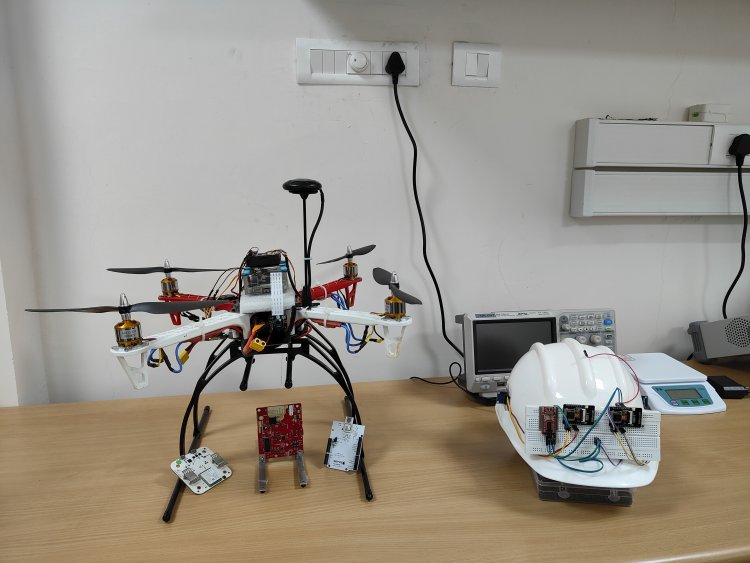
Researchers at the Indian Institute of Technology Madras (IIT Madras) have developed an innovative real-time indoor mapping solution that can generate precise maps under any lighting or environmental conditions, with minimal dependence on pre-existing infrastructure. This breakthrough technology is especially vital for first responders during disaster relief operations, as traditional infrastructure often becomes inaccessible or unreliable during public safety emergencies.
Called ‘UbiqMap’, this lightweight technology leverages radio frequency-based imaging to create detailed maps of indoor environments using a technique called ‘Radio Tomographic Imaging’ (RTI).
RTI systems traditionally rely on a network of wireless transceivers deployed at fixed, known locations. As these transceivers communicate, the wireless signal strength weakens when obstructed by structures. This reduction in signal power is analyzed to reconstruct the structural layout or floor map of the area.
UbiqMap introduces a dynamic and portable approach by eliminating the dependency on pre-installed infrastructure. Instead, it employs wearable transceivers that rescue personnel can easily wear. As team members move through the environment, these devices automatically determine their positions and continuously update the floor map, providing an accurate and real-time layout of the area.
In the long term, UbiqMap holds the potential to become a foundational technology for smart cities and autonomous systems, enabling advanced mapping operations in complex indoor environments.
This research was led by Dr. Ayon Chakraborty, Assistant Professor, Department of Computer Science and Engineering, IIT Madras. The research team also included Amartya Basu, MS student, and Kush Jajal, M.Tech student from IIT Madras. An Indian patent has been filed for this technology by the research team. The work has also been published in the reputed, peer-reviewed journal IEEE Transactions on Mobile Computing
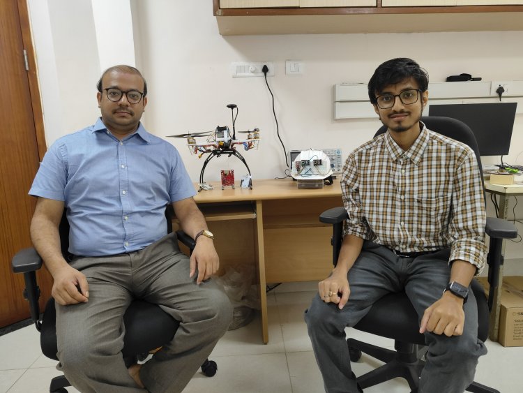
Dr Ayon Chakraborty (L), Dept of CSE, IIT Madras & Mr. Amartya Basu, Research Scholar, IIT Madras with the devices developed
Elaborating on the technology, Dr. Ayon Chakraborty said, “Public safety incidents, particularly search and rescue operations, are often hindered by the lack of accurate and up-to-date indoor building plans. Even when maps are available, they typically fail to capture real-time dynamics essential for effective mission planning during disasters. Our technology offers first responders a robust and portable tool to image indoor environments without dependence on visual line of sight or extensive computational resources, making it an invaluable asset in complex, time-critical scenarios.”
On the current status of the technology and its timeline for field implementation, Dr. Chakraborty added, “We have successfully tested the technology in a controlled setup within a few residential units on the IITM campus. These trials allowed us to validate the system’s functionality, though the movement and localization of the transceivers were carefully managed. A key ongoing focus is optimizing the choice of wireless frequency—balancing better indoor penetration with higher imaging resolution. We are also integrating UbiqMap with visual modalities using sensor fusion. Currently, we are prototyping a wearable version of the technology in preparation for real-world field trials.”
UbiqMap has the potential to transform public safety and disaster response. Its affordable, portable design makes it accessible to a wide range of users. The system can also complement existing tools like cameras, providing a more comprehensive solution for indoor mapping and localization.
Existing camera-based solutions for real-time mapping face significant limitations. They require a clear visual line of sight, making them ineffective in cluttered, obstacle-laden, or poorly lit environments. Moreover, such solutions often demand substantial computational infrastructure, rendering them impractical in emergencies.
In addition to creating detailed indoor maps, UbiqMap can estimate the material properties of mapped elements, such as distinguishing drywall from concrete or metal. This capability offers invaluable support to first responders, helping them design safer and more efficient evacuation or rescue routes in complex indoor environments.