Monsoon takes pause in Aug after Jul deluge, El Nino may further weaken rains
Monsoon seems to have reversed gear in August, with sustained dry spell in many regions of the country. What’s more worrying is that meteorologists in the US are saying there was 66% chance of El Nino developing into a strong event. This means El Nino’s effects could be felt in India too, weakening the monsoon further. Monsoon rains in August have been 29% lower.

 Join the RuralVoice whatsapp group
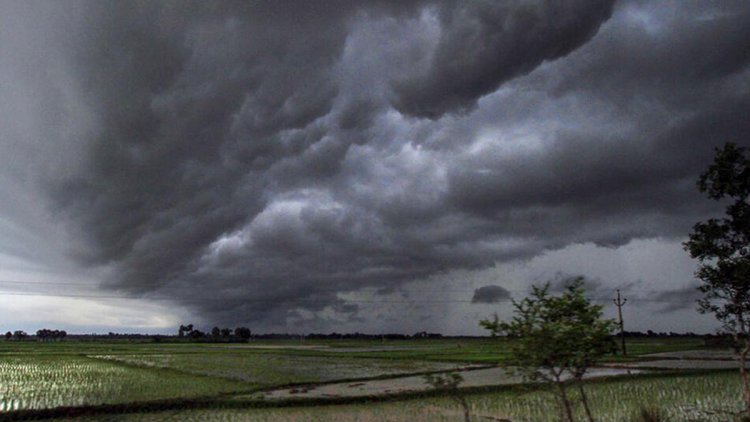
Monsoon seems to have reversed gear in August, with sustained dry spell in many regions of the country. What’s more worrying is that meteorologists in the US are saying there was 66% chance of El Nino developing into a strong event. This means, El Nino’s effects could be felt in India too, weakening the monsoon further. Overall, till now, Monsoon rains in India remain in the normal zone of +/-4%, but rains in August have been 29% lower.
The IMD had forecast that El Nino will suppress rainfall in August. It had forecast that July rainfall would be on the ‘positive side of normal’ or at most, 6% of what is usual for the month. However, a series of ‘Western Disturbances’ and active monsoon conditions saw July receive nearly 13% more rain than what is typical for the month. After the torrential rains in July, the month of August - usually the second rainiest of the four monsoon months - saw ‘below normal’ rains.
A strengthening El Nino and the absence of meteorological conditions that could have offset El Nino’s effects, combined to suppress rainfall in the second half of the monsoon. Usually, August gets 25.49 cm of rainfall.
“The rainfall averaged over the country as a whole during second half of the monsoon season (Aug–Sept) is most likely to be normal (94-106% of the long period average (LPA)), with a tendency to be on negative side of the normal. The rainfall averaged over the country as a whole during August, 2023 is very likely to be below normal (<94% of LPA),” the IMD noted. LPA refers to a 50-year- average called the Long Period Average.
On June 30, the IMD had forecast that July rainfall would be on the ‘positive side of normal’ or at the most, 6% of what is usual for the month. However, a series of ‘Western Disturbances’ (rain accentuating systems from Central Asia) and active monsoon conditions saw July receive nearly 13% more rain than what is typical for the month. Rainfall was expected to be subdued in northwest and southern India in July but the IMD’s forecast was off mark, with the northwest getting 25% more rain and Southern India, 45% more rain, than normal. East and northeast India saw depressed rains with 32% less rain than what is normal.
Northwest India, overall, got the maximum rain it has ever received since 2001 with Chandigarh, several parts of Haryana, Himachal Pradesh “breaking all-time records,” the IMD said in an analysis of the monsoon in July. Before the monsoon commenced in June, the IMD forecast rainfall for June-Sept to be 4% below normal. So far rains are 5% above what is usual for June and July combined.
“After the first week of August we will see a drying up of rainfall in most parts of India and monsoon activity will shift to the northeastern states, eastern India and Himalayan foothill states,” said DS Pai, senior meteorologist, IMD. July usually gets 28 cm of rainfall. “Along with the impact of El Nino (historically linked to a drying up of rain in north and northwest India), there are not too many supporting monsoon conditions to neutralise the effect of El Nino.”
Temperatures too are going to rise in August with ‘above normal’ temperatures over most part of south Peninsula, east and north-east India and some parts of northwest and Central India, the IMD had said in a statement.