'Vigorous' monsoon activity may bode well for India's agricultural landscape
For the first time in six decades, monsoon has covered both Delhi and Mumbai together. The Met office termed the monsoon activity over Haryana, Chandigarh and Delhi as 'vigorous'. According to the IMD, monsoon activity is considered 'vigorous' if the recorded rainfall is more than four times the normal or it is fairly widespread or widespread

 Join the RuralVoice whatsapp group
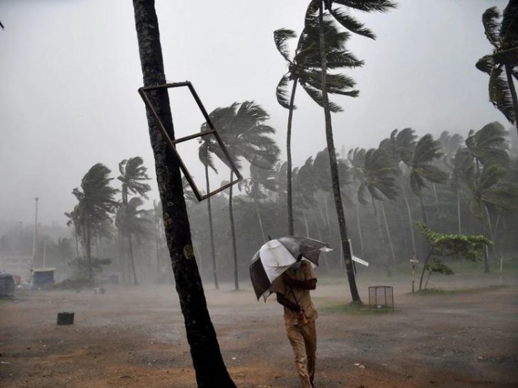
For the first time in six decades, monsoon has covered both Delhi and Mumbai together. The Met office termed the monsoon activity over Haryana, Chandigarh and Delhi as 'vigorous'.
According to the IMD, monsoon activity is considered 'vigorous' if the recorded rainfall is more than four times the normal or it is fairly widespread or widespread.
On June 20 Australia's Bureau of Meteorology said sea surface temperatures (SSTs) across the equatorial Pacific Ocean have warmed to El Nino threshold and are likely to rise by 3.2 degrees Celsius by November, well above the Indian Met’s forecast.
The formation of an El Nino is likely to affect the production of key crops and could even alter trade routes for their markets. What does this mean for India and how will it affect the southwest monsoon, cyclone formation, and agriculture?
El Niño, a weather phenomenon, disrupts ocean currents, temperatures and weather conditions across the world, leading to changes in global atmospheric circulation and longer, colder winters in certain regions.
In India, it causes the monsoon season to experience below-normal rainfall, droughts, and inadequate crop yield. According to the Indian Meteorological Department, there is a 70% probability of El Niño impacting the monsoon season in June, July and August.
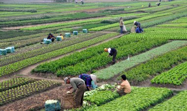
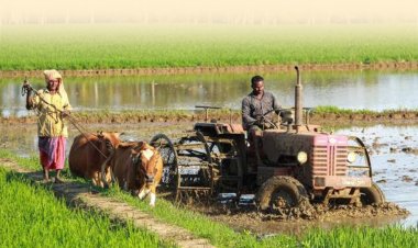
Normal rainfall is critical for India's agricultural landscape, with 52 per cent of the net cultivated area relying on it. Additionally, it plays a crucial role in replenishing reservoirs essential for drinking water and power generation throughout the country.
Rainfed agriculture accounts for approximately 40 per cent of the country's total food production, making it a vital contributor to India's food security and economic stability.
Conditions are favourable for further advance of the monsoon into some more parts of Gujarat, Rajasthan, Haryana, Punjab and the remaining parts of Jammu and Kashmir, the IMD said. Normally, the monsoon reaches Kerala by June 1, Mumbai by June 11, and the national capital by June 27.
"The southwest monsoon has further advanced into the remaining parts of Maharashtra, including Mumbai, Madhya Pradesh, Uttar Pradesh, Delhi, some parts of Gujarat, Rajasthan and Haryana, the remaining parts of Uttarakhand and most parts of Himachal Pradesh and some more parts of Jammu, Kashmir and Ladakh," the IMD said in a statement.
The trajectory that the monsoon followed this year is unusual.
While it covered a significant portion of north India, including Ladakh, Himachal Pradesh, Uttarakhand, and a large part of Jammu and Kashmir, on schedule or slightly ahead, it is running two weeks behind schedule for a considerable part of central India, where a significant number of farmers heavily rely on it.
Cyclone Biparjoy had impacted the monsoon's progress over southern India and the adjoining western and central parts of the country, said DS Pai, a senior scientist at the India Meteorological Department (IMD).
"Since the system absorbed most of the moisture, the monsoon's progress along the west coast was slow," he explained.
However, the Bay of Bengal branch of the monsoon, responsible for bringing rain to northeast and east India, remained stronger between June 11 and June 23.
Pai attributed this to a low-pressure system that formed over the Bay of Bengal in mid-June and the remnants of Cyclone Biparjoy, which aided the monsoon's advancement over east India. He noted that the Arabian Sea branch of the monsoon is now gaining strength with a low-pressure system developing over the Bay of Bengal.
This year, the monsoon arrived in Kerala on June 8, a week after its usual onset date of June 1. In comparison, it reached the southern state on May 29 last year, June 3 in 2021, June 1 in 2020, June 8 in 2019 and May 29 in 2018.
Research indicates that a delay in the onset of monsoon over Kerala does not necessarily result in a delay in its arrival over northwest India nor does it impact the total rainfall over the country during the season.
The IMD previously stated that India is expected to receive normal rainfall during the southwest monsoon season despite the evolving El Nino conditions. El Nino, which is the warming of the waters in the Pacific Ocean near South America, is generally associated with the weakening of monsoon winds and dry weather in India.
The IMD's prediction of 'normal' monsoon, however, doesn't mean that each part of the country will log good rainfall during the season. It essentially means that the total rainfall will be within the normal limits though there could be excess precipitation at some places and deficient at others.
Northwest India is predicted to experience normal to below-normal rainfall while the east, northeast, central and the south peninsula regions are expected to receive normal rainfall at 94-106 per cent of the long-period average.