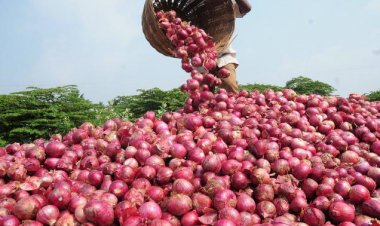
Agri Ministry signs MoU with Pixxel Space to develop geospatial solutions
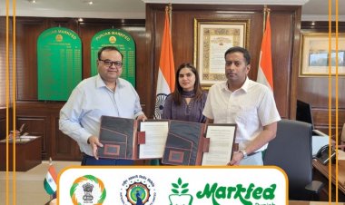
The Union Agriculture Ministry has signed an MoU with Pixxel Space India Pvt Ltd to develop various geospatial solutions, mainly for monitoring the health of crops and soil. The MoU (Memorandum of Understanding) was signed on Monday in the presence of Agriculture Secretary Manoj Ahuja.

 Join the RuralVoice whatsapp group
The Union Agriculture Ministry has signed an MoU with Pixxel Space India Pvt Ltd to develop various geospatial solutions, mainly for monitoring the health of crops and soil. The MoU (Memorandum of Understanding) was signed on Monday in the presence of Agriculture Secretary Manoj Ahuja.
C S Murthy, Director of MNCFC, signed the MoU on behalf of the Government of India, with Abhishek Krishnan, Chief of Staff representing Pixxel Space. MNCFC (Mahalanobis National Crop Forecast Centre) on behalf of the ministry will associate with the Pixxel team for developing and implementing suitable methodologies.
"It aims to develop various geospatial solutions on pro bono basis for the Indian Agriculture Ecosystem using Pixxel's hyperspectral dataset. The project focuses on leveraging sample hyperspectral data from Pixxel's path finder satellites to develop analytics models focused on crop mapping, crop stage discrimination, crop health monitoring, and soil organic carbon assessments," an official statement said.
This will enable the government to develop cases with hyperspectral data provided by Pixxel. "Hyperspectral remote sensing technology includes spectral measurements in narrow wavelength bands by satellites and such measurements offer certain unique indices to monitor and assess the health of crops and soils," the statement said.
This is an emerging technology with unique capabilities for monitoring agriculture. Crop health monitoring by detecting the changes in chlorophyll content and canopy moisture status, using hyperspectral data would be beneficial to find crop risk management solutions for farmers.
Soil nutrient mapping including soil organic carbon assessments is one of the important applications of hyperspectral technology. The soil reflectance observations measured by the sensors offer more direct, cost-effective data sets to estimate soil organic carbon. "This will also help to develop the early detection of crop stress, accurate diagnostics of crop stress due to pest/disease or water using hyper spectral data offer numerous opportunities to strengthen the current advisory system of the Government benefiting to millions of farmers," the statement said.
Ahuja said such types of collaboration with young startup company will go a long way toward developing innovative geospatial solutions using advanced satellite imaging technology. The new technology will reduce dependence on manual surveys and measurements which are time-consuming and prone to errors.